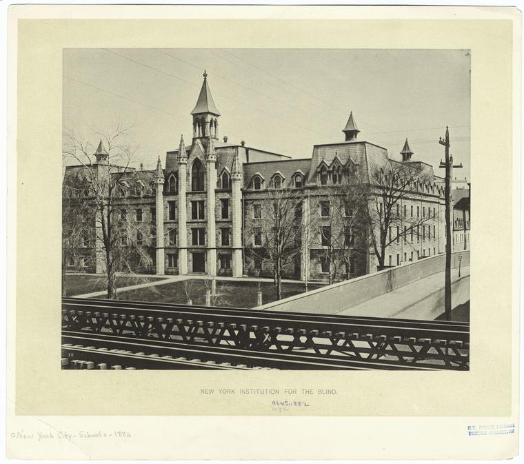
Adress: West 59th StreetBorough: Manhattan, New York City
- Status: completed
- Building Type: Public Building
Positioning on an old map
Plate 17: Bounded by W. 64th Street, Eighth Avenue, W. 59th Street (Central Park), Sixth Avenue, W. 52nd Street, and (Hudson River) Twelfth Avenue. 1885
Historic map finder tool
Picture of St Pauls Convent - NYC
Publicity
Information about this place
This public building
Building located there after
South Park Tower View page
NewyorkBeforeID:25891 - 1088 pageview since 2016-03-16
References
-
Search New York City buildings database
-
Interesting building around
MuseumChurchApartment TowerTall BuildingPublic BuildingNear playground
 8 m W 64 St, W/s Amsterdam Ave
 40.76749460899719 -73.98208124932353 Museum Art and Design 23334 10 2008 430 1 Columbus Circle 40.76993424884077 -73.98508250713348 Church of St. Paul the Apostle 23761 3 1884 71 405 West 59th Street, New York, NY 10023 / Columbus Avenue 40.76989584383882 -73.98505836725235 Church of St. Paul the Apostle 23912 4 1885 74 405 West 59th Street, New York, NY 10023 40.77107991379855 -73.9867240190506 175 West 60th 23911 48 2016 134 175 West 60th Street 40.771527 -73.985898 Alfred Condominiums 20458 37 1987 165 161 West 61st Street 40.768799 -73.987132 435 West 57th Street 22682 0 1963 172 435 West 57th Street, between 9th & 10th Avenues, north side 40.770979 -73.986166 McMahon Hall 22472 20 1950 106 155 West 60th Street 40.768968 -73.98541 One Columbus Place Tower I 20285 49 1999 127 400 West 59th Street 40.769301 -73.98585 One Columbus Place Tower II 20286 49 1999 83 400 West 59th Street 40.769963 -73.985914 South Park Tower 20205 51 1986 9 124 West 60th Street to West 59th Street 40.769508 -73.984981 Two Columbus Avenue 22014 0 1998 99 2 Columbus Avenue at West 59th Street, NW corner 40.770043560146284 -73.9859139919281 St Pauls Convent 25891 0 0 0 West 59th Street
