Adress: 340 West 55th StreetDistrict: MidtownDistrict: Hell's Kitchen / ClintonBorough: Manhattan, New York City
- Year completed: 1924
- Floor : 11
- Building Type: Apartment Tower
Positioning on an old map
Plate 17: Bounded by W. 64th Street, Eighth Avenue, W. 59th Street (Central Park), Sixth Avenue, W. 52nd Street, and (Hudson River) Twelfth Avenue. 1885
Positioning on an old map
Columbus Circle - New York - Detailed Map 1916 1916
Historic map finder tool
Picture of The Sherwood - NYC
About this place
340 West 55th Street in Hell's Kitchen / Clinton , this apartment tower was built in 1924
To know more
We can't provide information on price or availability.
NewyorkBeforeID:21885 - 733 pageview


- New York Map
-
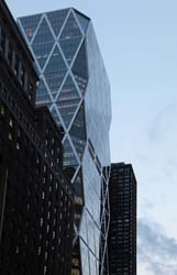
Interesting building around
MuseumOfficesChurchApartment TowerTall BuildingPublic Building40.76749460899719 -73.98208124932353 Museum Art and Design 23334 10 2008 346 1 Columbus Circle 40.766603 -73.983661 Hearst Tower 20103 46 2006 182 959 8th Avenue 40.76520642628731 -73.98477539420128 Saint George Greek Orthodox Church 23726 2 1886 111 307 West 54th Street 40.766571 -73.985109 330 West 56th Street 22273 23 1974 82 330 West 56th Street 40.767334 -73.984951 Parc Vendome Condominiums North 20976 0 1929 164 340 West 57th Street 40.767026 -73.985243 Parc Vendome Condominiums South 21614 0 1931 124 333-353 West 56th Street 40.766668 -73.984165 The Sheffield 20219 50 1978 148 325 West 56th Street, 322 West 57th Street 40.765953 -73.985646 The Sherwood 21885 11 1924 0 340 West 55th Street 40.764653 -73.984916 Metro 20953 0 1980 157 301 West 53rd Street 40.76523 -73.984321 Westerly 22521 19 1964 138 300 West 55th Street 40.76519293596992 -73.98435831069946 Manhattan Hall 25890 0 0 137 915-919 8th Avenue 40.76493057784387 -73.98506782202276 New York City Police Department - Midtown North Precinct 25168 4 0 124 306 W 54th St, New York, NY 10019