Adress: 23th StreetBorough: Manhattan, New York City
- Building Type: Public Building
Positioning on an old map
Plate 11 1885 1885
Positioning on an old map
Flatiron District- Historic Map 1916 1916
Positioning on an old map
Chelsea s Farm 1815
Historic map finder tool
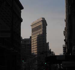
Picture of Saint Vincent de Paul - NYC
Information
About this place
This public building
NewyorkBeforeID:21406 - 654 pageview


- New York Map
Near Subway station
-
23rd St
- LINE : 1-2
-
23rd St
- LINE : F-M
-
Interesting building around
Tall BuildingChurchApartment TowerTall BuildingPublic BuildingHotelNear playground
 11 m W 26, 8 To 9 Aves
 40.741031 -73.989648 Flatiron Building 20753 22 1902 422 175 5th Avenue and Broadway 40.743586822234086 -73.99366021156311 Saint-Vincent de Paul 23790 2 1869 32 123 West 23rd Street, New York, NY 10011 40.741843 -73.994816 21 Chelsea Apartments 21779 0 2002 188 120 West 21st Street, between 6th & 7th Avenues, south side 40.743737 -73.994486 Chelsea Mews Apartments 21649 0 1920 84 148 West 23rd Street 40.743067 -73.993945 Citizen 21483 16 2012 35 124 West 23rd Street 40.742953 -73.994489 133 West 22nd Street 21345 0 2009 79 133 West 22nd Street 40.74338 -73.994583 144 West 23rd Street 21865 13 1989 77 144 West 23rd Street, between 6th & 7th, south side 40.74388 -73.992437 Chelsea Stratus 20246 40 2008 122 101 West 24th Street 40.742959 -73.9924 Masonic Hall 20726 19 1909 113 73 West 23rd Street, 46-54 West 24th Street 40.743737 -73.994229 Selis Manor 21983 0 1980 68 135 West 23rd Street, between 6th & 7th Avenues, north side 40.742431 -73.992695 The Caroline 21079 19 2002 127 700 6th Avenue 40.744445 -73.995044 The Chelsea 21489 0 1987 172 160 West 24th Street at 7th Avenue, SE corner 40.742823 -73.994164 Verde Chelsea 21782 0 2008 67 125 West 22nd Street 40.74329768567532 -73.99367094039917 Saint Vincent de Paul 21406 0 0 0 23th Street 40.744684699910636 -73.99447828531265 157 W 24th Street 26273 19 2020 169 157 West 24th Street 40.743569 -73.993093 Hampton Inn Chelsea 21434 16 2003 57 108 West 24th Street