Adress: City Hall PlaceDistrict: Civic CenterDistrict: Downtown / Lower ManhattanBorough: Manhattan, New York City
- Year completed: 1939
- Floor : 1
- Architect: Maginnis & Walsh, Robert J. Reiley
- Building Type: Church
Positioning on an old map
plate 4 1885 1885
Historic map finder tool
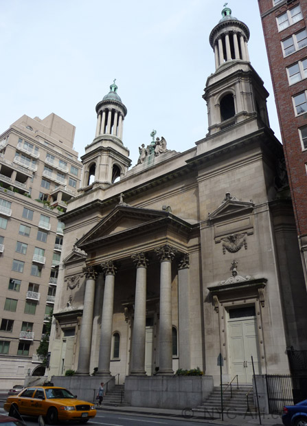
Picture of St Andrews Roman Catholic Church - NYC
Information
About this place
Located in Downtown / Lower Manhattan , this church design by Maginnis & Walsh, Robert J. Reiley was completed in 1939
Hours of masses and other religious events from this churches are not shown because they are subject to change.
NewyorkBeforeID:23688 - 584 pageview
- New York Map
Near Subway station
-
Brooklyn Bridge - City Hall
- LINE : 4-5-6-6 Express
-
Chambers St
- LINE : J-Z
-
Interesting building around
OfficesBridgeOfficesChurchTall Building40.712895 -74.003724 Manhattan Municipal Building 20116 34 1914 106 1 Centre Street 40.70887809364078 -74.0004301071167 Brooklyn Bridge 23801 0 1883 528 Manhattan - New York City 40.713659 -74.002544 Thurgood Marshall United States Courthouse 20106 37 1936 37 40 Centre Street, 505 Pearl Street 40.71333259865508 -74.00260135531425 St Andrews Roman Catholic Church 23688 1 1939 0 City Hall Place 40.713948 -74.00389 Court Square Building 20774 24 1926 128 2 Lafayette Street 40.714224 -74.001455 New York County Courthouse 21714 0 1926 138 60 Centre Street, between Pearl, Hamill Place and Worth Streets 40.714222222222 -74.00152777777 New York County Courthouse 23269 0 0 134 Manhattan - New York City 40.713611111111 -74.00277777777 United States Courthouse 23259 0 1932 34 40 Centre Street


