New York Map
Interesting building around
Offices
Church
Apartment Tower
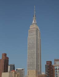
Tall Building
Hotel
Store
Gimbels Administration Building [+]
Address
132 West 32nd Street, between 6th & 7th Avenues, to 119 West 31st Street
Borough : Manhatan
Architecture
Year built 1912
Storey 16
Architects William H. Gompert
Picture
[+]Building type
setKeyword
Near Subway station
-
Herald Sq - 34th St
- LINE : N-Q-R
-
28th St
- LINE : 1-2
-
34th St - Penn Station
- LINE : 1-2-3
-
Herald Sq - 34th St
- LINE : B-D-F-M
Next, Random
message contain
New York
4316 places - 802 images
copyright 2016-2025 NewYorkBefore.com - Architecture, Heritage & History in NYC - All Right Reserved
copyright 2016-2025 NewYorkBefore.com - Architecture, Heritage & History in NYC - All Right Reserved