New York Map
Interesting building around
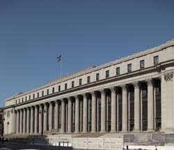
Public Building
Offices
Church
Apartment Tower
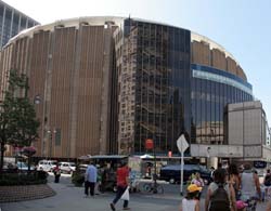
Tall Building
Theater
Hotel
Near playground
347 West 36th Street Loft [+]
Address
347 West 36th Street, between 8th & 9th Avenues, north side
District: Hell's Kitchen / Clinton
District: Garment District
Borough : Manhatan
Architecture
Year built 1928
Architects George & Edward Blum
Picture
[+]+ floorsBuilding type
setKeyword
Near Subway station
-
Times Sq - 42nd St
- LINE : N-Q-R
-
Times Sq - 42nd St
- LINE : 7-7 Express
-
Times Sq - 42nd St
- LINE : 1-2-3
Next, Random
message contain
New York
4316 places - 802 images
copyright 2016-2025 NewYorkBefore.com - Architecture, Heritage & History in NYC - All Right Reserved
copyright 2016-2025 NewYorkBefore.com - Architecture, Heritage & History in NYC - All Right Reserved