What's around   Go | | place | Link
New York Map
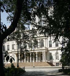
40.712895-74.003724Manhattan Municipal Building201163419142511 Centre Street40.712464-74.008176Woolworth Building20021571913264233 Broadway at Barclay Street40.71283135028198-74.00595813989639New York City Hall2381931811158City Hall Park, New York, NY 10007, 40.71446-74.00647Broadway Chambers Building2105118190038277 Broadway at Chambers Street, NW Corner40.713935-74.005108Emigrant Industrial Savings Bank227861719129251 Chambers Street to Reade Street40.713492-74.007254Home Life Insurance Building20788161894128256-257 Broadway40.71415487415909-74.007436037063612 Warren Street2602212201611212 Warren Street40.71409780068925-74.00680303573608265 Broadway2620442202061265 Broadway40.714525-74.006406281 Broadway211490201139281 Broadway, 57 Reade Street40.714751-74.00574287 Broadway Building231150064Manhattan - New York City40.714972-74.006041291 Broadway2256919191180291 Broadway at Reade Street, NW corner40.71425-74.00611111111A. T. Stewart Dry Goods Store / Sun Building23155718450280 Broadway40.715159-74.005896Barclay Building2106001905103299 Broadway40.714444444444-74.00638888888Broadway-Chambers Building2318118190032277 Broadway40.713888888889-74.00527777777Emigrant Industrial Savings Bank Building (Former)23205019098151 Chambers Street40.714765-74.005151Federal Office Building2026434199499290 Broadway at Reade Street, NE Corner to Duane Street40.715485-74.005634Mutual Reserve Fund Life Association Building21346131894143305 Broadway at Duane Street, NW Corner40.713378-74.007457Postal Telegraph Building2123401894149253 Broadway at Murray Street, NW Corner40.714249-74.006964Tower 270204750193072270 Broadway

A. T. Stewart Dry Goods Store / Sun Building [+]

Address

280 Broadway
District: Civic Center
District: Downtown / Lower Manhattan
Borough : Manhatan

Architecture

Year built 1845
Storey 7
Designated as New York City Landmark - October 7, 1986

Picture

Panorama view (set)
[+]

Building type

set
Keyword

More about this building

Landmark notice(pdf)

Near Subway station

    Brooklyn Bridge - City Hall - LINE : 4-5-6-6 Express
4 m
    Chambers St - LINE : A-C
4 m
    Park Pl - LINE : 2-3
6 m
    Chambers St - LINE : 1-2-3
6 m
    World Trade Center - LINE : E
7 m
    Chambers St - LINE : J-Z
4 m
    City Hall - LINE : N-R
3 m

Next, Random
message contain
 
New York
  • Battery Park City
  • Central Park
  • Chelsea
  • Chinatown
  • Civic Center
  • Downtown / Lower Manhattan
  • East Harlem
  • East Village
  • Financial District
  • Flatiron District
  • Garment District
  • Greenwich Village
  • Hell's Kitchen / Clinton
  • Kips Bay
  • Lenox Hill
  • Lincoln Square
  • Little Italy
  • Lower East Side
  • Meatpacking District
  • Midtown
  • Morningside Heights
  • Murray Hill
  • NoHo
  • SoHo
  • Time Square
  • Tribeca
  • Turtle Bay
  • Two Bridges
  • Upper East Side
  • Upper West Side
  • Washington Height
  • West Village
  • Yorkville

  • 4310 places - 802 images
    © 2016-2024 NewYorkBefore.com - Architecture, Heritage & History in NYC - All Right Reserved