Adress: 315 East 38th StreetBorough: Manhattan, New York City
4131
- Status: completed
Positioning on an old map
The NYPL DIGITAL COLLECTIONS Atlas of the borough of Manhattan, city of New York - 1916 plate 68 1916
Positioning on an old map
Plate 13: Bounded by W. 40th Street, E. 40th Street, First Avenue (Harlem River, Lumber Yards), E. 27th Street, W. 27th Street and Sixth Avenue. 1885
Positioning on an old map
Farms of New York - old map 1815 1815
Historic map finder tool
Picture of 315 EAST 38th Street - NYC
Publicity
Information about this place
This
NewyorkBeforeID EAST_38_STREET.315, BIN: 1021923
Last update of this page
This year comes from NYC DOB and may not be precise.
References


-
Search New York City buildings database
-
Interesting building around
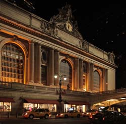
Public BuildingOfficesApartment TowerTall Building40.752361229901794 -73.9775937795639 Grand Central Station 20000 2 1913 727 42th Street 40.751654 -73.975298 Chrysler Building 20006 77 1930 568 405 Lexington Avenue 40.747635 -73.973324 300 East 39th Apartments 22186 0 2001 91 300 East 39th Street at 2nd Avenue 40.74745474686316 -73.97153788791911 685 First Avenue 24014 42 0 125 685 1st Avenue 40.748021 -73.972868 Churchill Apartments 20420 32 1967 124 300 East 40th Street at 2nd Avenue, SE Corner to East 39th Street 40.746477 -73.973007 The Corinthian 20161 55 1988 49 645 1st Avenue, 345 East 37th Street, 330 East 38th Street to Entrance Street 40.747147 -73.972321 The New York Tower 22042 36 1982 51 330 East 39th Street, between 2nd & 1st Avenues, south side 40.747285 -73.973292 Whitney Condominiums 22154 30 1986 57 311 East 38th Street 40.748127 -73.971714 2 Tudor City Place South Tower 22705 0 1955 166 2 Tudor City Place 40.74742 -73.973656 301 East 38th Street 22933 0 1929 90 301 East 38th Street at 2nd Avenue, NE corner 40.746842 -73.973495 The Montrose 21179 0 2000 56 308 East 38th Street