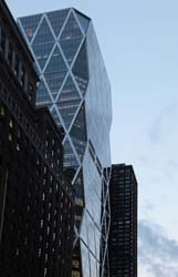
Adresse: 340 West 55th StreetDistrict: MidtownDistrict: Hell's Kitchen / ClintonArrondissement: Manhattan, New York City
- Year completed: 1924
- Étages : 11
- Type d'édifice: Tour résidentielle
Positionnement de cet édifice sur une carte ancienne
Plate 17: Bounded by W. 64th Street, Eighth Avenue, W. 59th Street (Central Park), Sixth Avenue, W. 52nd Street, and (Hudson River) Twelfth Avenue. 1885
Positionnement de cet édifice sur une carte ancienne
Columbus Circle - New York - Detailed Map 1916 1916
Historic map finder tool
En image: The Sherwood - NYC
340 West 55th Street in Hell's Kitchen / Clinton, tour résidentielle 1924
Nous ne pouvons pas fournir d'nformations sur le prix de location ainsi que sur la disponibilité.
NewyorkBeforeID:21885 - 744 page vue since 2015-01-11
- New York Map
-
Édifices d'intérêt autour
MuseeBureauEgliseTour residentielleTour a bureauCulture sport et loisir40.76749460899719 -73.98208124932353 Museum Art and Design 23334 10 2008 346 1 Columbus Circle 40.766603 -73.983661 Hearst Tower 20103 46 2006 182 959 8th Avenue 40.76520642628731 -73.98477539420128 Saint George Greek Orthodox Church 23726 2 1886 111 307 West 54th Street 40.766571 -73.985109 330 West 56th Street 22273 23 1974 82 330 West 56th Street 40.767334 -73.984951 Parc Vendome Condominiums North 20976 0 1929 164 340 West 57th Street 40.767026 -73.985243 Parc Vendome Condominiums South 21614 0 1931 124 333-353 West 56th Street 40.766668 -73.984165 The Sheffield 20219 50 1978 148 325 West 56th Street, 322 West 57th Street 40.765953 -73.985646 The Sherwood 21885 11 1924 0 340 West 55th Street 40.764653 -73.984916 Metro 20953 0 1980 157 301 West 53rd Street 40.76523 -73.984321 Westerly 22521 19 1964 138 300 West 55th Street 40.76519293596992 -73.98435831069946 Manhattan Hall 25890 0 0 137 915-919 8th Avenue 40.76493057784387 -73.98506782202276 New York City Police Department - Midtown North Precinct 25168 4 0 124 306 W 54th St, New York, NY 10019
